Case Study: Catchment Analysis and Community Engagement

In collaboration with Newcastleton District Community Trust

Setting the Scene

Formed in 2015, Newcastleton and District Community Trust (NDCT) is a membership organisation aimed at blending community needs, environmental stewardship and strategic tourism development, with a mission to boost local economic growth while developing the land sustainably. Priorities are set by local people for the benefit of the whole community, with all projects based on sustainable outcomes. 

The NDCT covers the catchments of Newcastleton and Upper Liddesdale, located on the Scotland/England border. Newcastleton itself has a population of 762, making it a small, resilient, remote rural community, 25 miles from the nearest urban hub, describing themselves as a landlocked island due to their isolated location.

In 2020, NDCT acquired 303 hectares of land adjacent to the village of Newcastleton on behalf of the community. To determine the use of the site, extensive community consultation and initial feasibility work were carried out, with outcomes which are detailed in the ‘Holm Hill Path Planning Report April 2024.’

With environmental stewardship at its core, collaboration with the Rethink Carbon team and use of the Rethink Platform is helping NDCT to streamline the scoping, planning, and engagement processes of projects. As plans turn into actions, the Rethink Platform provides the tools to assess the environmental baseline across the landscape, whilst modelling future scenarios. By integrating a robust community feedback mechanism, the collaboration works towards the project’s alignment with local needs and sustainability goals.

Map of northern UK and southern Scotland, highlighting in red the Newcastleton Community Council and Upper Liddesdale and Hermitage Community Council catchments on the Scotland-England Border.

Project 1: NDCT Land & Catchment Analysis

NDCT works at a catchment scale in order to understand what factors might have an influence over issues facing the local community, such as flood risk. The requirement therefore, was to be able to analyse not only NDCT’s land, but the entire catchment to map out the relationship between the land and the community whilst planning projects. 

Analysing over 25,000 hectares of land is traditionally a time consuming activity. With the use of the Rethink Platform, NDCT were able to upload the catchment boundary and analyse over 100 key datasets in under 60 seconds, saving hours or days of work.

Access to datasets such as land use, runoff, watercourses, soils, climate, slope, elevation, archaeological sites and more, all in one place, has made this data easily accessible to NDCT and its stakeholders. 

Newcastleton is prone to flooding and has experienced multiple flood events in the past. By utilising Rethink Carbon’s own hydrology layers such as channel flows and flow accumulation with flood risk, land use, habitats, and soils has helped identify areas that could be managed to mitigate flood risk. 

Scoping projects for the 303-hectare site is important to visualise how NDCT’s plans integrate with the wider catchment. With access to over 100 datasets at their fingertips, the Rethink Platform has enabled NDCT to run early stage project scoping and reporting, and provides tools to run future scenario modelling such as woodland creation (with Woodland Carbon Code integration). 

With 3D base mapping data analysis is brought to life, helping provide context to these data layers, and acting a fantastic tool in communicating and sharing data with the community.

“Using the Rethink Carbon platform has enabled us to fully understand the land we have. The channel flows, soil types and habitats data layers have helped inform our planning from a very early stage. It is such a visual tool which allows us to share information with the community at consultation events in a way they can see how it directly impacts on them and has helped us to gather more relevant and useful feedback.”

V. Hawes, NDCT
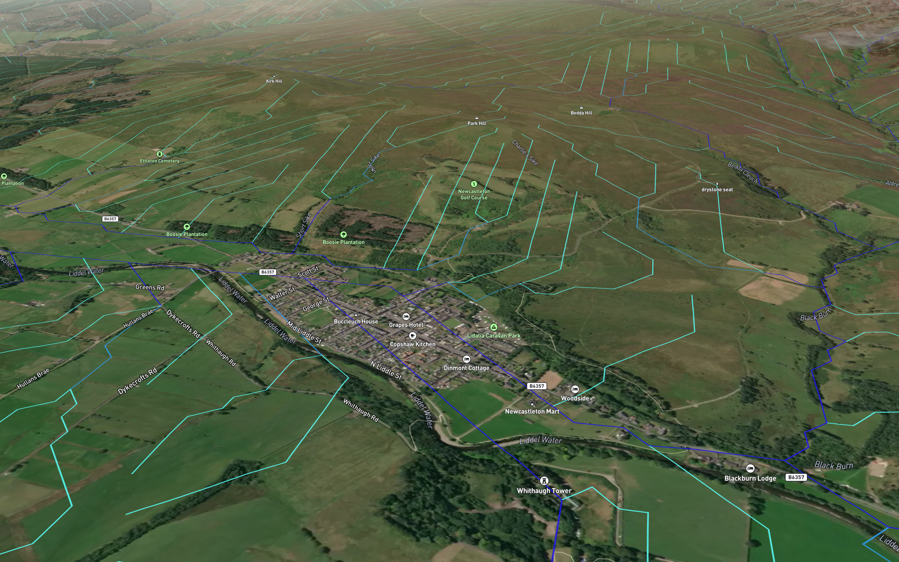
‘Channel Flows’ layer created using analysis from a digital terrain model built from OS Terrain 50 data, on the Rethink Platform over the Newcastleton catchment area.
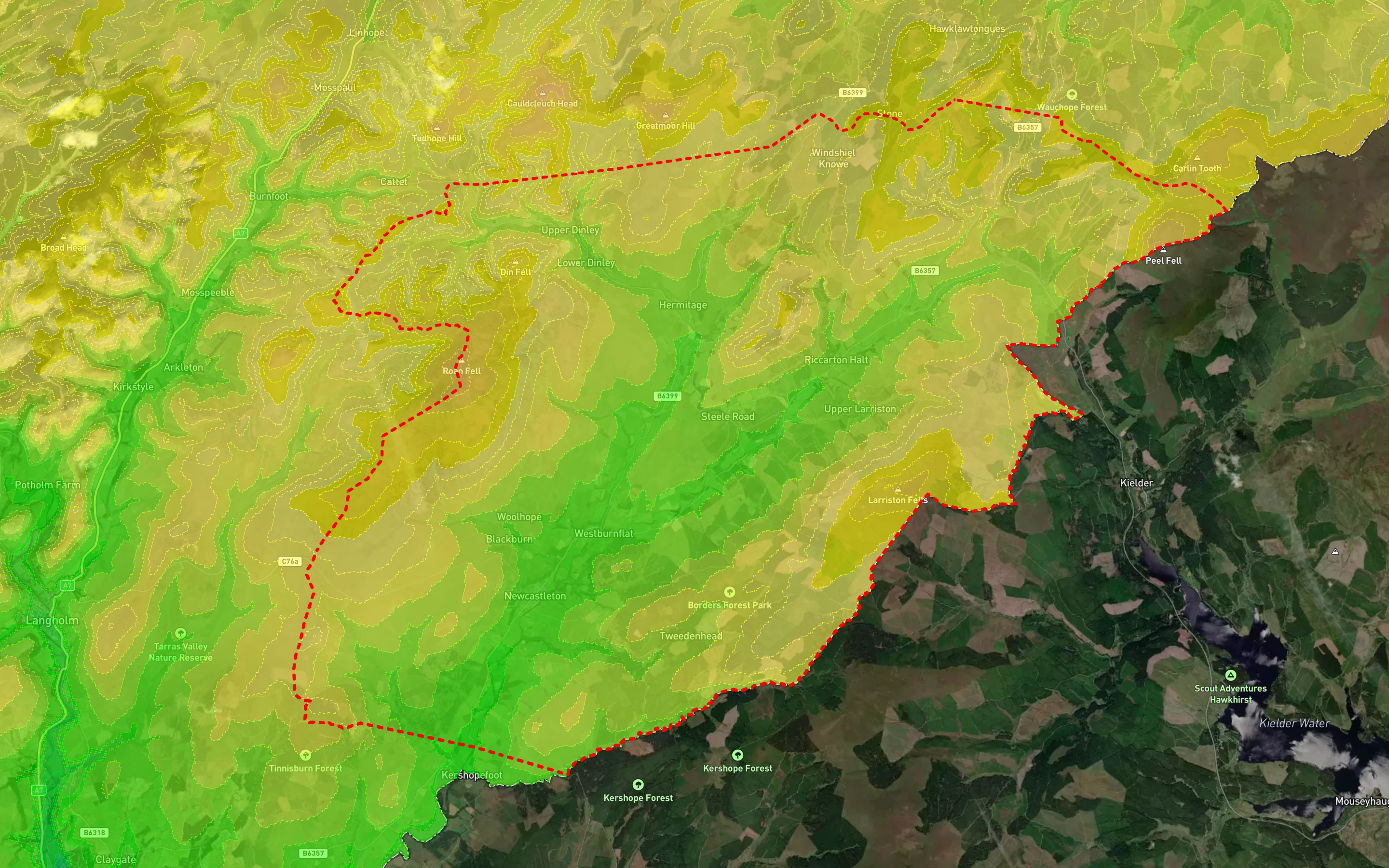
‘Elevation’ layer created using data from OS Terrain 50 on the Rethink Platform over the Newcastleton catchment area.
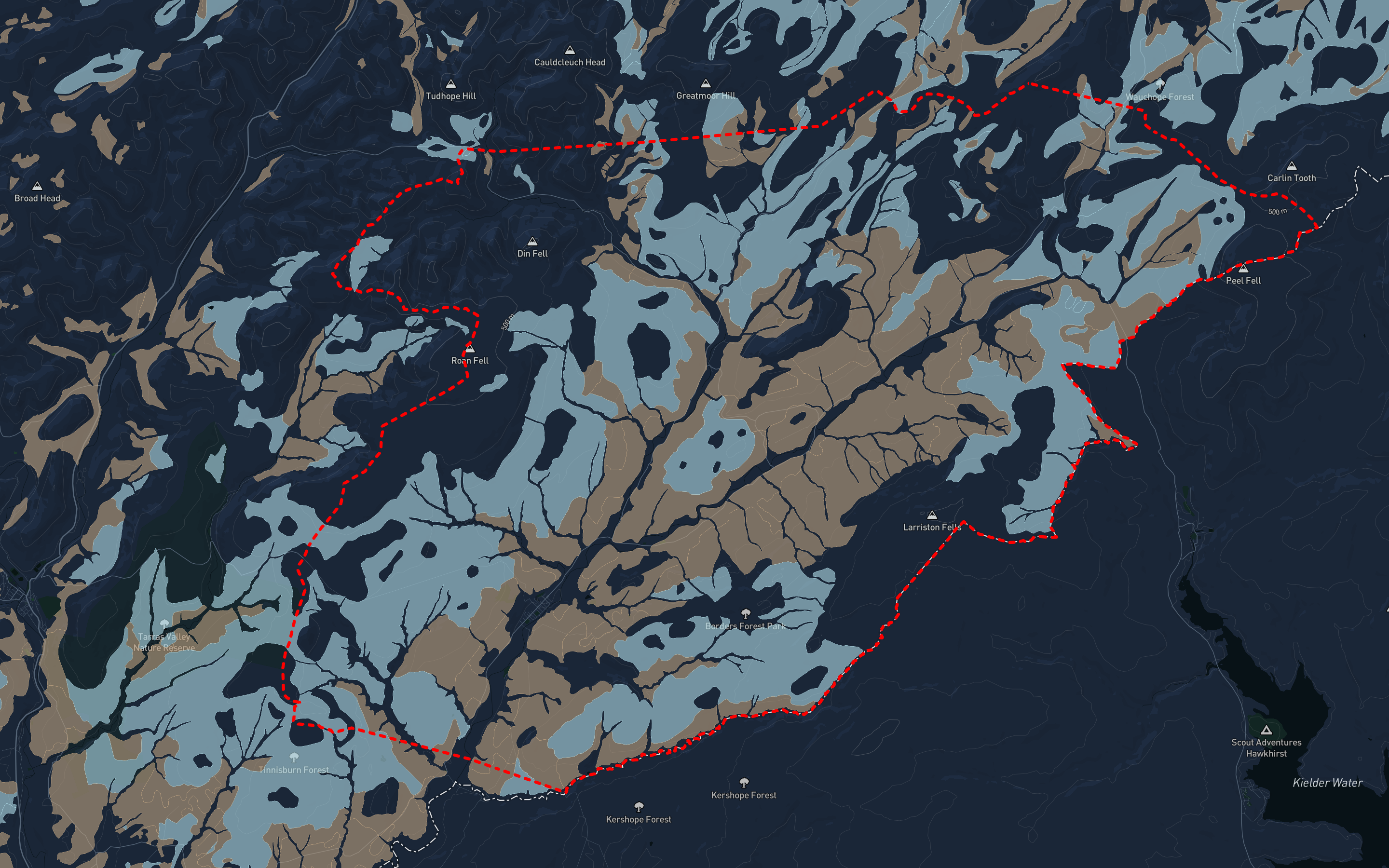
‘James Hutton Soils 25k’ showing peaty gleys (blue) and mineral gleys (brown) on the Rethink Platform over the Newcastleton catchment area.
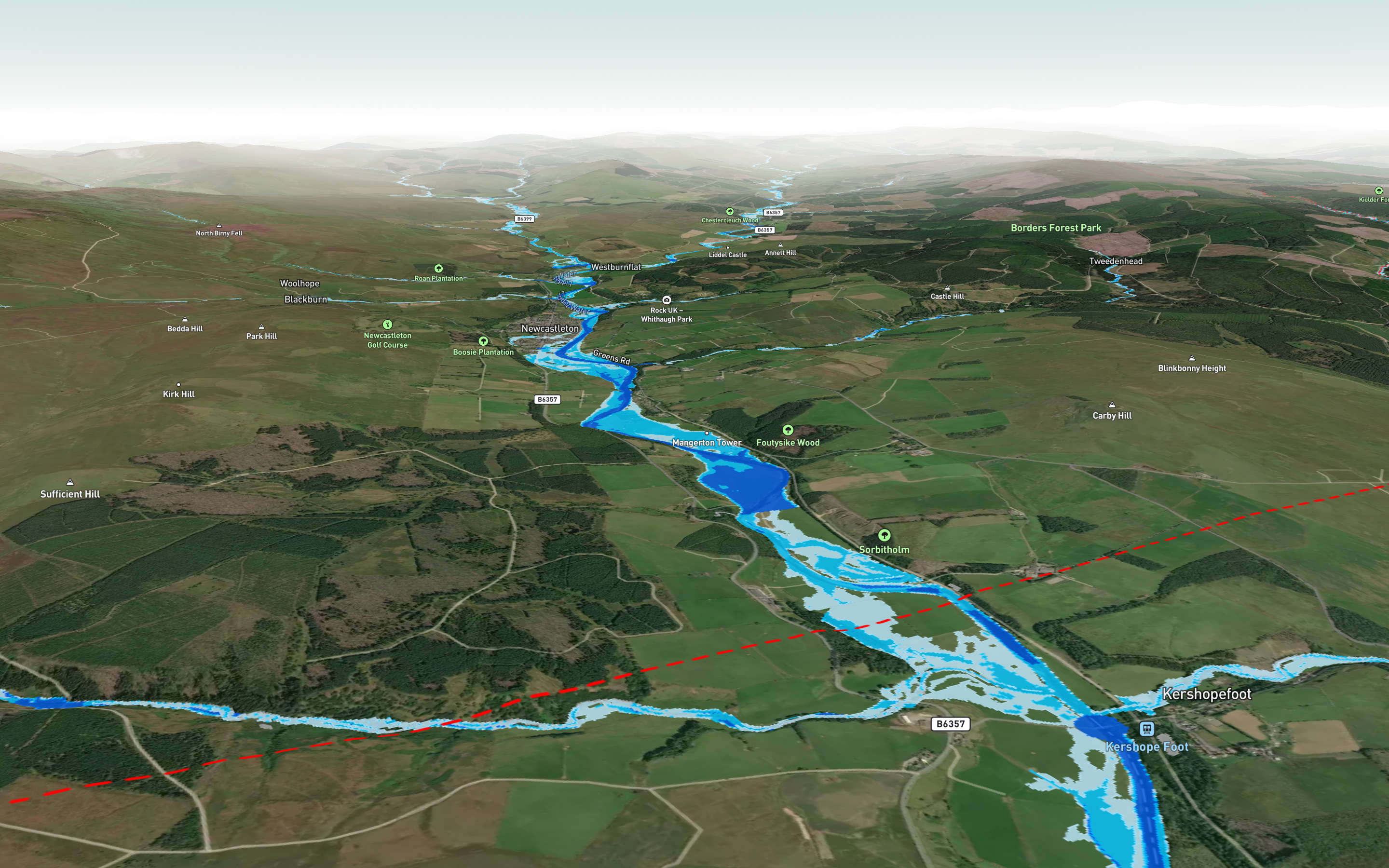
‘SEPA High Flood Risk from Rivers’ on the Rethink Platform over a section of the Newcastleton catchment area.

These four example datasets highlight factors such as impermeable soils, descending elevation towards Newcastleton and the flow of water towards the village – affecting the risk of flooding.

A summary of platform benefits:

  • Analysing over 25,000 hectares of land across the catchment in seconds, providing a dynamic visualisation of over 100+ key spatial datasets.
  • Providing an interface to easily present data over 3D mapping to engage the local community and stakeholders in new ways.
  • Managing land based projects and future scenario planning in one centralised platform.

Project 2: NDCT Active Leisure Hub - Community Engagement Tooling

NDCT plan to create a community outdoor gathering space in the land surrounding the Active Leisure Hub, making this a showcase and maximising the site’s panoramic views. A path network which meanders around John Byers monument – an area that the community has been unable to access for many years – will be wheelchair accessible and will wind up to the Active Leisure Hub and the main garden, a place to reflect and take in the views at different angles. From there, the potential to take one of the new paths for a longer, more challenging walk across to Blackburn falls where the views are breathtaking, giving walkers the chance to spot rare flora such as the white orchid or visit some of the local areas of archaeological interest.

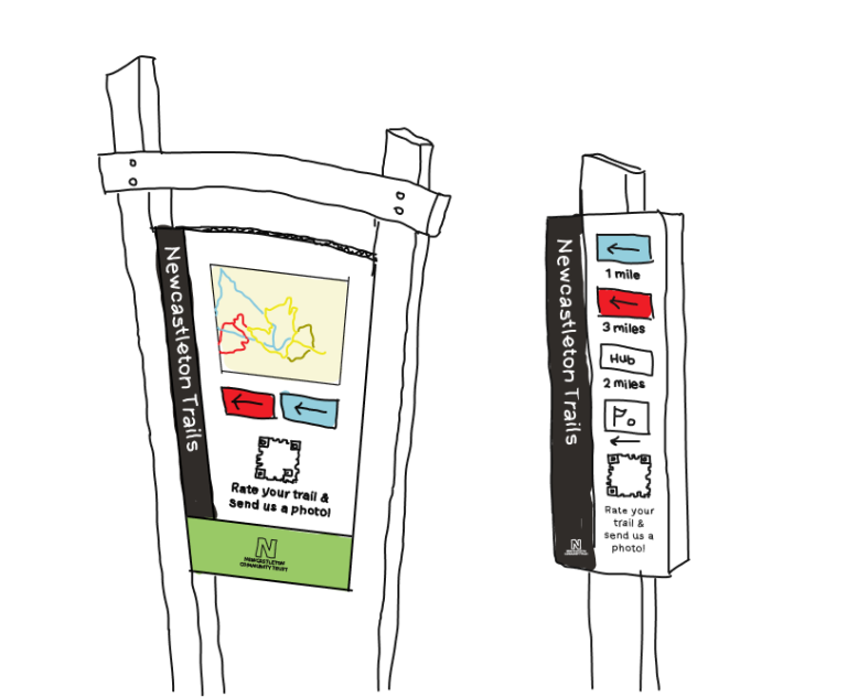
Trail signage across the site and Hub will be simple but effective. It will support the ‘visitor journey’ with messaging, branding, a website link, trail maps, and other information that the visitor may need. 

The Rethink Platform provides the tools to draw map features or to import pre-existing GIS layers onto a map, such as new paths. Plans can be easily shared with stakeholders or the community through the Platform’s ‘one-click’ sharing functionality, with further options to collect feedback about the project or to allow stakeholders to upload photos.  

Maps can be shared through a QR code, which NDCT plans to incorporate into their signage as part of the new path development. This will enable any member of the public to scan the QR code from a static point, and to upload photos of the view across the valley or any plants or animals they might spot along the path. This sort of interaction allows the community to be part of the project, and allows NDCT to monitor the area for biodiversity and habitat recording, as well as a collection of images showing the landscape over time. Comments and feedback can also be collected with the QR code.

These community tools allow NDCT to obtain real-time feedback from the project, where all site data, photos, comments and ratings are stored in one place, and can be shared as part of the  Hub’s updates, keeping the community ‘in the loop’.

“Using the Platform to share ideas with other key project members has been a great way to keep everyone focussed on the project. This has potential to allow the community to feed in – sharing their views about specific areas and upload their pictures. The walks and paths suddenly now have an exicting opportunity to become interactive. We have rare species of animnals and plants along the walk. Walkers lucky enough can spot these are share the location, which would benefit others. Walkers can share their own shots, building a community in itself and further enhancing our tourism market.”

V. Hawes, NDCT

Below is a mock-up of the signage at the Community Garden.

Digital mockup sketch of two sign posts showing path maps and a Rethink Carbon community QR code

A summary of benefits from future plans:

  • Streamlining community engagement methods, such as QR-code data collection, to maximise the use of feedback.
  • Centralisation of project data and community engagement in one Platform.
  • New, interactive methods of engaging with the community and members of the public.

What's To Come

The images below evidence the first two phases of ‘planning’ (prior to Rethink Carbon involvement) and the ‘before.’ Phase three and four will be the ‘during’ and ‘after’, which aim to image the development of the Active Leisure Hub.

Planning

Before

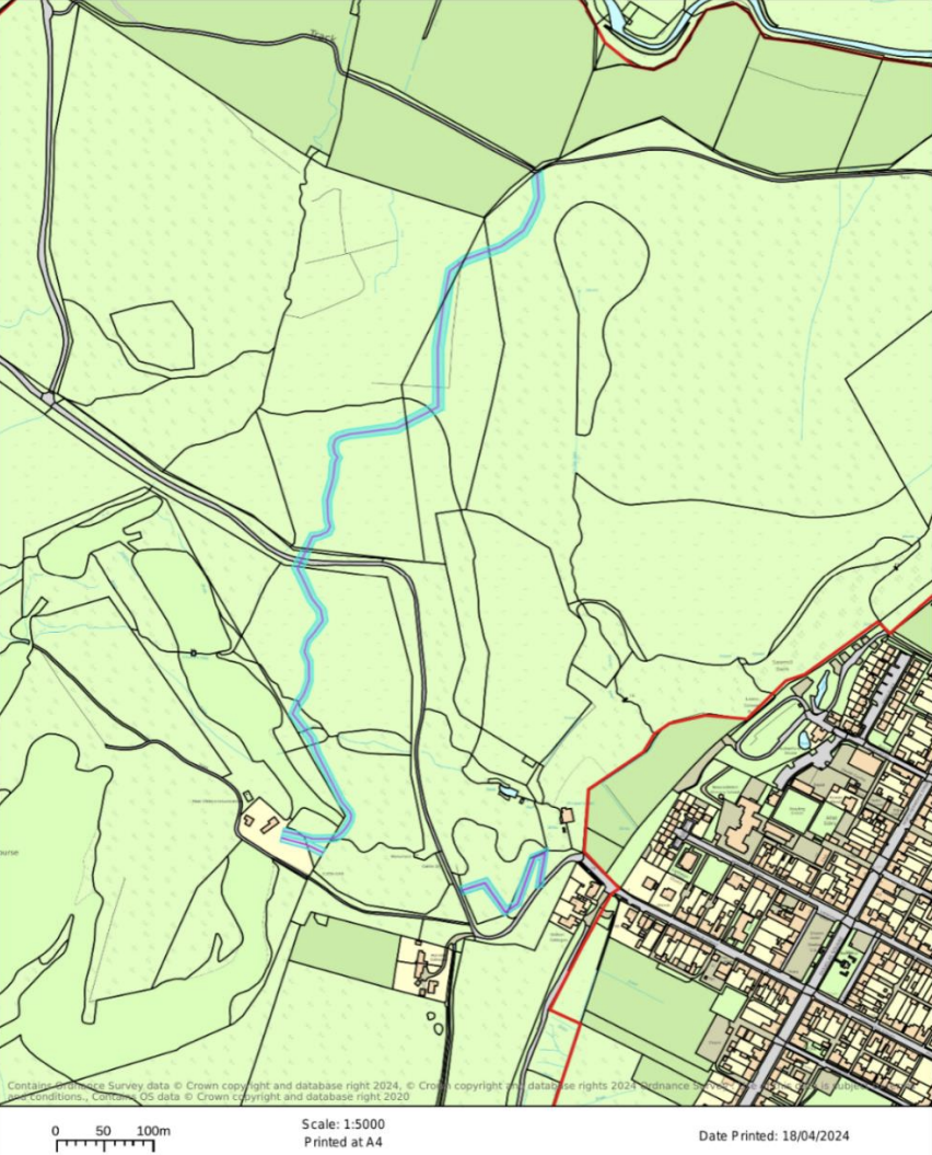
Track Plan for Multi Use Paths
Track plan for multi-use paths (NDCT).
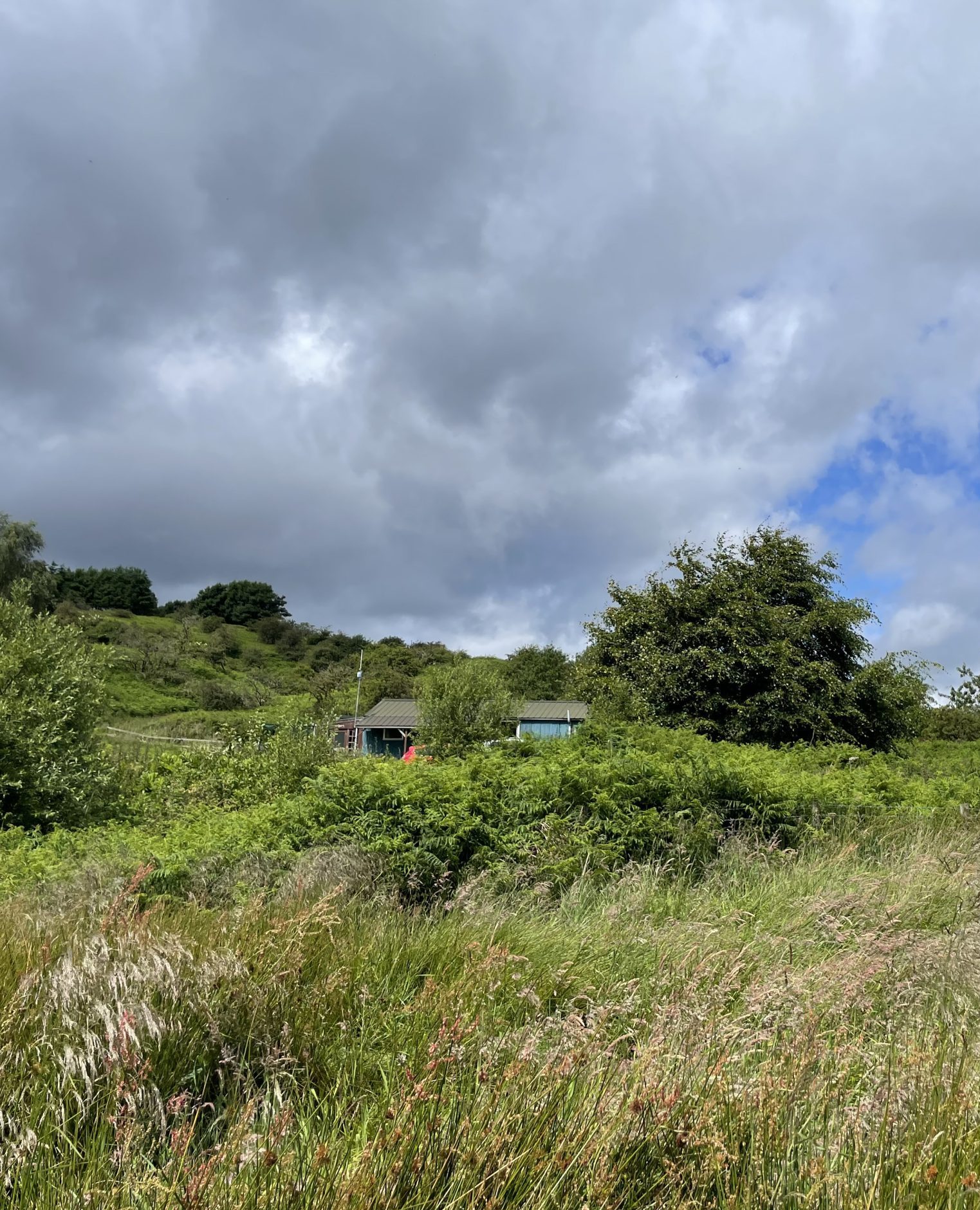
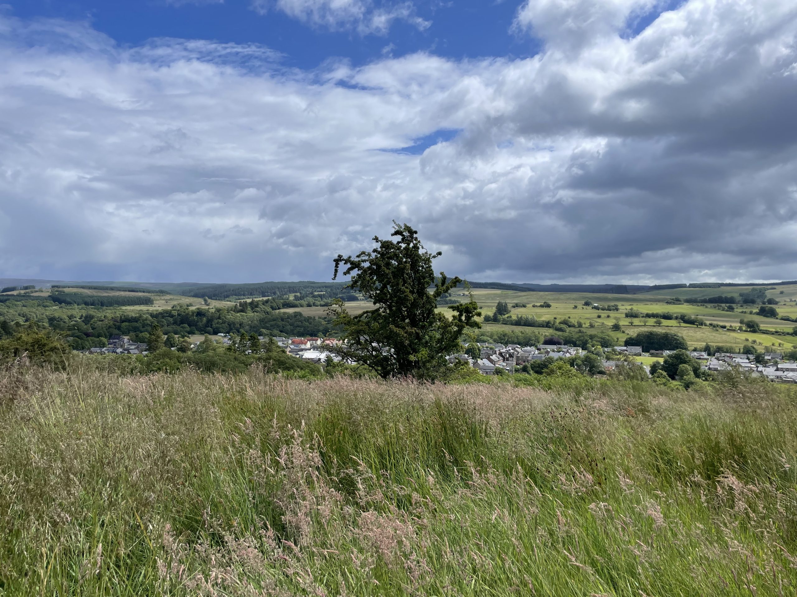
Image taken by Rethink Carbon towards the current Hub. Overgrown fields
Photo towards the current Hub, with overgrown fields and lack of paths. Taken by Rethink Carbon.
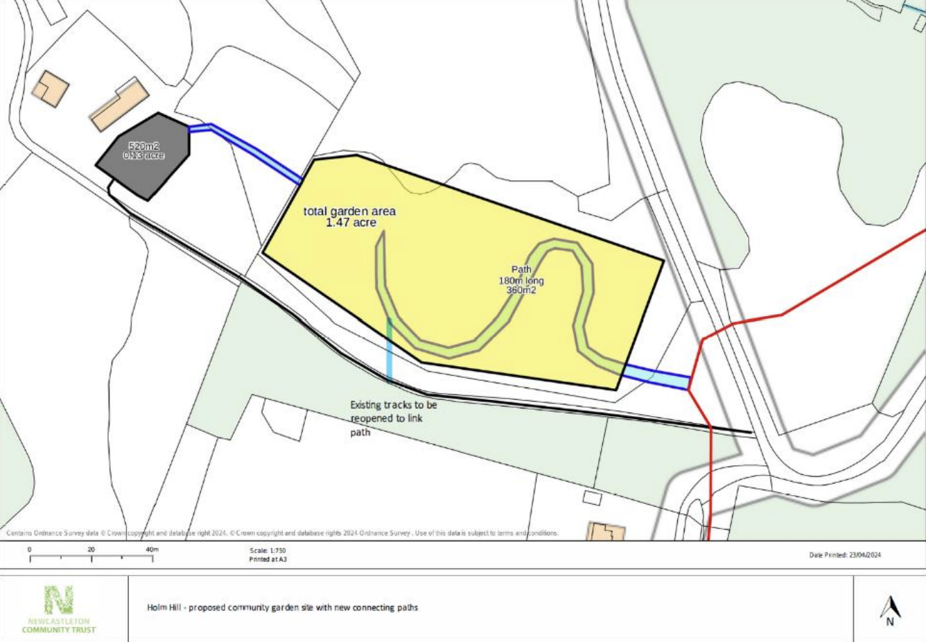
Community Garden Plan
Community Garden plan (NDCT).
Photo over the valley, with overgrown fields and lack of paths connecting Newcastleton below
Photo over the valley, with overgrown fields and lack of paths connecting Newcastleton below. Taken by Rethink Carbon.
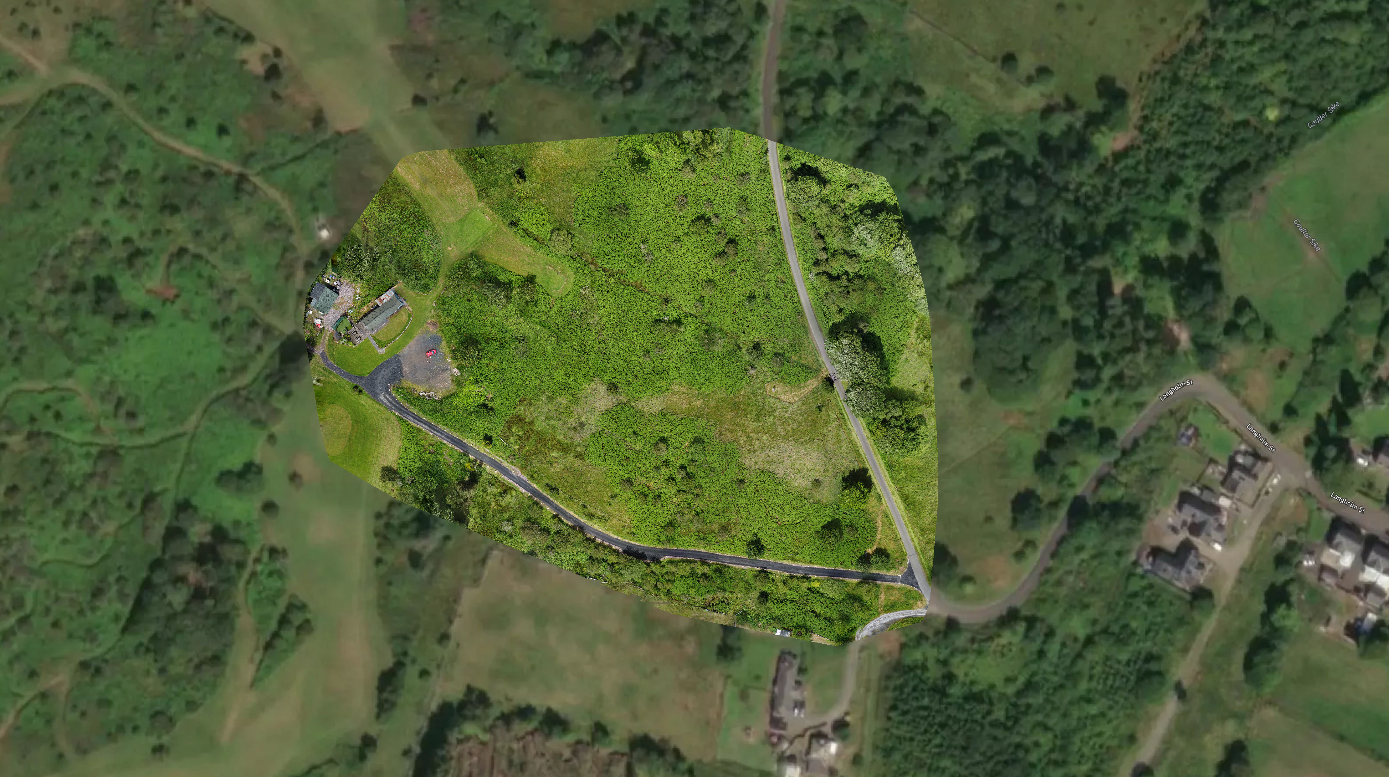
Drone image taken by Rethink Carbon of the proposed NDCT Community Garden area
Drone image taken by Rethink Carbon of the proposed NDCT Community Garden area.

We are looking forward to implementing these exciting plans and assisting NDCT throughout their transformative journey. Stay up to date by subscribing to the Rethink Carbon newsletter and viewing the latest NDCT news.

Documented by 

Tessa Buckley (Rethink Carbon)
Freddie Ryan (Rethink Carbon)
Vicky Hawes (NDCT)

Get in touch

info@rethinkcarbon.co.uk
vicky.hawes@newcastletoncommunitytrust.co.uk

Newcastle Community Trust logo
Funded bu UK Government logo
Scottish Borders Council logo

The Newcastleton District Community Trust project is part-funded by the UK government through the UK Shared Prosperity Fund.

The automated land management platform for restoring nature and unlocking new revenue streams.

£99

Included with the
Premium Insights upgrade.

Visualise the Future of land use with
our scenario builder.

Scenario planning, natural capital reporting, AI Discovery and much more included with the Premium Insights upgrade.

Natural Capital
Reporting

included

Enhanced Opportunity
Mapping

Included

Scenario planning
Workspaces

included

AI Powered
Discovery

Included

Our Workshops

A short introduction to the workshop instructors and why their background should inspire potential student’s confidence.