

The land management platform
you've been waiting for.
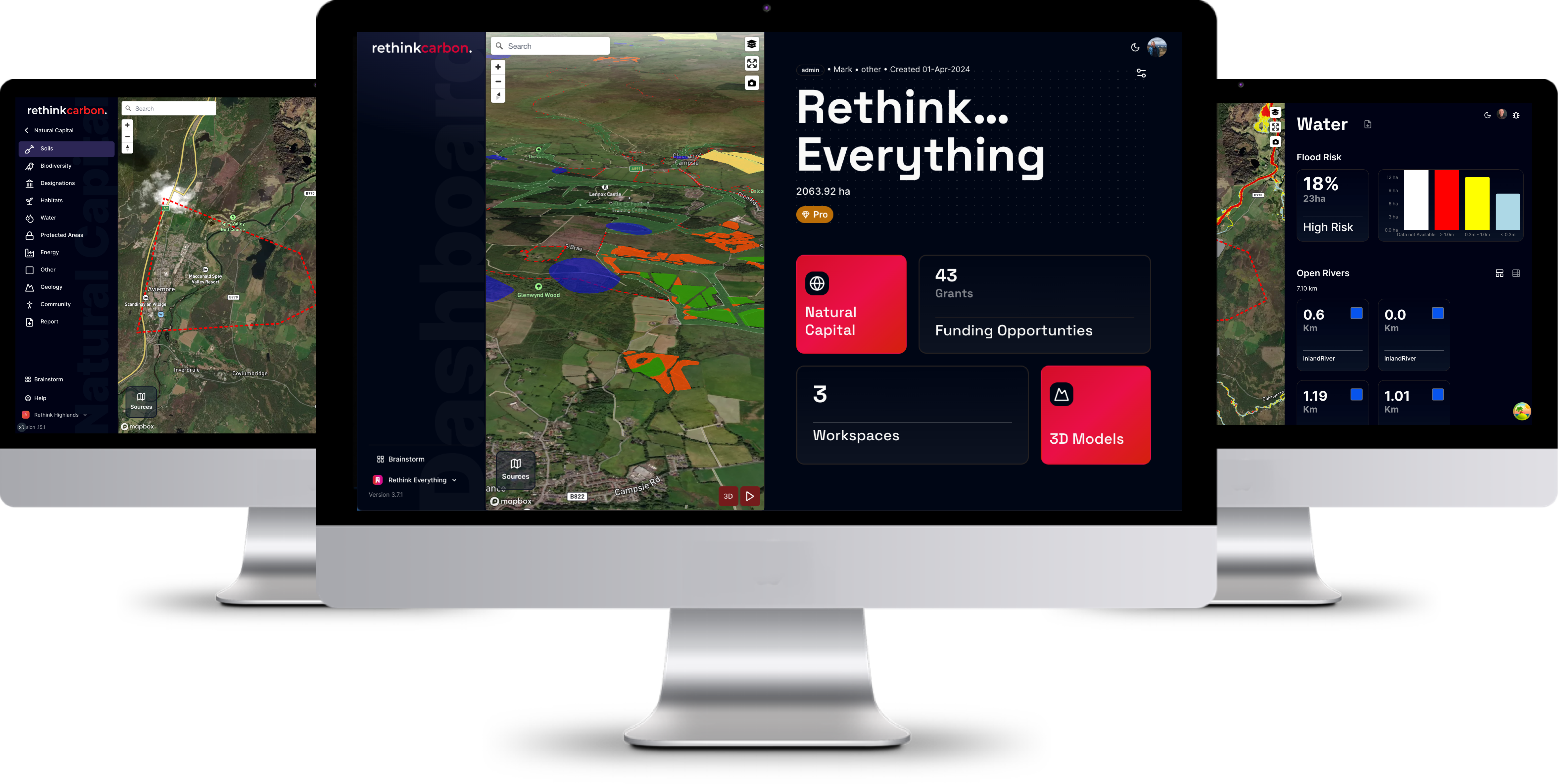
Are you ready for this?
Customer Reviews
“In my opinion it is the most innovative technology currently available to land managers. It's a user friendly system that saves weeks worth of work and gives a clear visual representation of data.”
Jamie Buchanan-Jardine
Director, Castlemilk and Corrie Estates
“This is the carbon, conservation and community platform that every land manager has a duty to use. Now. It is so intuitive, functional and practical enabling land managers to make the right decisions for their land, their communities and the planet.
Mike Daniels
Head of Policy, John Muir Trust
Frequently asked questions
What datasets are included in my Early Bird subscription?
As standard, the Early Bird subscription gets access to the following layers:
- Soil 250k
- LCA 250k
- LCF 250k
- Peat and Carbon Class 2016
- Ancient Woodland Inventory
- National Forest Inventory
- Space Intelligence 2020
- OS Open Rivers
- Country Parks
- Local Nature Conservation Sites
- Regional Parks
- Local Landscape Areas
- Local Nature Reserves
- Geological Conservation Review Sites
- National Scenic Areas
- National Nature Reserves
- National Parks
SSSI
Biosphere Reserve - World Heritage Site
- Ramsar
- SAC
- SPA
Battlefields
Conservation Areas - World Heritage Sites
- Properties in Care
- Canmore Archeological Points
- Canmore Archeological Polygons
- Gardens and Designed Landscapes
- Listed Buildings
- Scheduled Monuments
- OS Greenspace
- Environmentally Sensitive Areas
What extra datasets do I get with a Premium Insights upgrade?
In addition to the standard layers, a premium insights property upgrade adds the following:
- Soil 50k
- LCA 50k
- Peat Depths
- Space Intelligence 2022
- Vegetation Height
- SEPA High Flood Risk Area
- SEPA Inter Catchments
- SEPA River Classification
- Aspect
- Slope
- Elevation
- BGS Bedrock
- BGS Superficial
- Radon
- Direct Normal Irradiation (DNI)
- EPC
- Highland Council Area Wind Turbines
- Onshore Windfarm Proposals
- SPD Grid Stations
- SPD Primary Substations
- SSEN Substation Primary
- Windspeed
- Lidar (beta)
- Channel Flows (beta)
- Flow Accumulation (beta)
- OS Terrain 50 Contours
I don't want to get tied in, can I cancel or downgrade at any time?
You can cancel your subscription at any time using the online portal. Your account will be closed at the end of the next billing cycle.
How large a property can I analyse?
With an Early Bird subscription, you can analyse an unlimited number of properties up to 250 hectares.
If you purchase a Premium insights upgrade for your property, you can enter up to 25,000 hectares.
What extra do I get from the paid property upgrade?
The standard plan is enough for most users, but if you want to access the advanced geospatial layers or interact with the AI system, then the upgrade is for you. You also get access to our specialist email support team as well as advanced Nat Cap download reports.